Jinotega
 |
 |
The city is located in a long valley surrounded by the cool climate and Dariense Isabelia ridge located 142km north of the capital Managua. In 2012, the Department of Jinotega had a total population of 417,372, of which 123,548 lived in the capital city. Of the total population, 50.5% are men and 49.5% are women, and almost 38.4% of the population lives in the urban area. Jinotega produces 80% of Nicaragua's coffee, which is exported to the United States, Russia, Canada and Europe.
Within the city of Jinotega are several rivers and a lake. Lake Apanas, an artificial lake of 51 square kilometers, provides hydropower to much of the country. Although there is debate as to the origin of the name, Jinotega is colloquially known as "The City of Mists" (Ciudad de la Brumas) for the magnificent whisks of clouds continuously feathering through the top of the valley. Other generally accepted names are "The Eternal City of Men", and the "City of Eternal Men".
Jinotega is bordered to the
* north by the municipalities of Santa María de Pantasma and Wiwili
* south by the municipalities of Matagalpa and Sébaco
* east by the municipalities of El Cua, Bocay, and Tuma La Dalia
* west by the municipalities of La Trinidad, San Rafael del Norte, La Concordia, and San Sebastian de Yali
* Mountains: Cuspire, Chimborazo, Kilambe (1750m), Peñas Blancas, Zinica, Saslaya, Baba, Asan Rahra
* Valleys: Jinotega city, Pantasma, Cuá, Wiwilí, Wamblan, Bocay
Map - Jinotega
Map


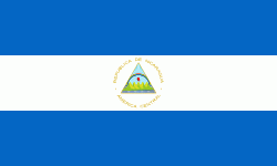
Country - Nicaragua
 |
 |
| Flag of Nicaragua | |
Originally inhabited by various indigenous cultures since ancient times, the region was conquered by the Spanish Empire in the 16th century. Nicaragua gained independence from Spain in 1821. The Mosquito Coast followed a different historical path, being colonized by the English in the 17th century and later coming under British rule. It became an autonomous territory of Nicaragua in 1860 and its northernmost part was transferred to Honduras in 1960. Since its independence, Nicaragua has undergone periods of political unrest, dictatorship, occupation and fiscal crisis, including the Nicaraguan Revolution of the 1960s and 1970s and the Contra War of the 1980s.
Currency / Language
| ISO | Currency | Symbol | Significant figures |
|---|---|---|---|
| NIO | Nicaraguan córdoba | C$ | 2 |
| ISO | Language |
|---|---|
| EN | English language |
| ES | Spanish language |